| Jan 23, 2014 |
'Space cops' to help control traffic in space
|
|
(Nanowerk News) A team of Lawrence Livermore National Laboratory scientists are using mini-satellites that work as "space cops" to help control traffic in space.
|
|
The scientists used a series of six images over a 60-hour period taken from a ground-based satellite to prove that it is possible to refine the orbit of another satellite in low earth orbit.
|
|
"Eventually our satellite will be orbiting and making the same sort of observations to help prevent satellite-on-satellite and satellite-on-debris collisions in space," said Lance Simms, lead author of a paper appearing in an upcoming edition of the Journal of Small Satellites.
|
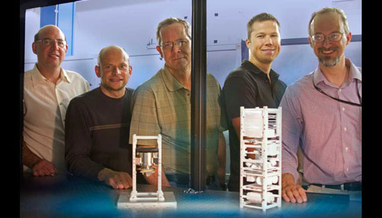 |
| From left to right: Brian Bauman, Vincent Riot, Darrell Carter, Lance Simms and Wim De Vries have developed and tested land-based mini-satellites that eventually will be used in space to help control traffic in space.
|
|
Collisions in space of satellites and space debris have become increasingly problematic.
|
|
To help satellite operators prevent collisions in space, the Space-Based Telescopes for Actionable Refinement of Ephemeris (STARE) mission, which will consist of a constellation of nano-satellites in low earth orbit, intends to refine orbits of satellites and space debris to less than 100 meters. STARE is an ongoing LLNL project led by Wim de Vries, with Vincent Riot as lead engineer.
|
|
Using the ground-based satellite, the Livermore team refined the orbit of the satellite NORAD 27006, based on the first four observations made within the initial 24 hours, and predicted NORAD's trajectory to within less than 50 meters over the following 36 hours.
|
|
By refining the trajectory of NORAD 27006 with their ground-based payload, the team believes they will be able to do the same thing for other satellites and debris once their payload is orbiting earth.
|
|
The tools and analysis used to capture the images of NORAD 27006 and refine its orbit are the same ones that will be used during the STARE mission.
|
|
"This leads credence to the capability of STARE to accomplish its mission objectives," De Vries said.
|
|
Accurately predicting the location of a satellite in low earth orbit at any given time is difficult mainly because of the uncertainty in the quantities needed for the equations of motion. Atmospheric drag, for instance, is a function of the shape and mass of the satellite as well as the density and composition of the unstable atmosphere. These uncertainties and the incompleteness of the equations of motion lead to a quickly growing error in the position and velocity of any satellite being tracked in low earth orbit.
|
|
To account for these errors, the Space Surveillance Network (SSN) must repeatedly observe the set of nearly 20,000 objects it tracks; however, positional uncertainty of an object is about 1 kilometer. This lack of precision leads to approximately 10,000 false alarms per expected collision. With these large uncertainties and high false alarm rates, satellite operators are rarely motivated to move their assets after a collision warning is issued.
|
|
The STARE mission aims to reduce the 1 kilometer uncertainty down to 100 meters or smaller, which will in turn reduce the number of false alarms by roughly two orders of magnitude, Riot said.
|
|
In the case of the Livermore team, they were able to reduce the uncertainty to 50 meters, well below the 100-meter goal.
|