| Jan 10, 2013 |
China no longer reliant on satellite image imports |
| (Nanowerk News) It was announced at a seminar reviewing the research and development of Ziyuan III held on Wednesday, one year after the satellite was launched. |
| China used to import over 90 percent of its remote-sensing data, according to the seminar. |
| The launch of Ziyuan III has enhanced the country's capability to capture space remote-sensing images, bolstered state security and boosted the geo-information industry. |
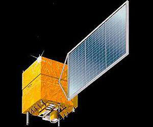 |
| The Ziyuan III satellite |
| Also according to the seminar, China plans to build a remote-sensing mapping satellite system in 10 to 15 years. Three follow-up mapping satellites are already in the pipeline. |
| The Ziyuan III 02 satellite is likely to be launched in early 2014, allowing the two orbiters to form a network, so that real-time data on any given point on earth can be retrieved throughout the day. |
| The satellite, a high-resolution remote-sensing satellite for civilian use, was launched on Jan. 9, 2012. It is expected to compete with its foreign counterparts that currently dominate the country's hi-res remote-sensing and mapping market. |
| The satellite is tasked with offering services to aid the country's land-resources surveys, natural-disaster prevention, agricultural development, water-resources management and urban planning. |
| It has a designed life expectancy of five years. |
| Source: Xinhua |

