| Jan 10, 2023 |
Researchers develop AI method for mapping planets |
| (Nanowerk News) Can the mapping of planets become an automated process? Scientists from Constructor University in Bremen, Germany, the University of Padua, and the University of Bologna have now developed a novel, open-source approach for the mapping of planetary landforms using artificial intelligence. |
| The pre-release version of the deep learning program was published in the American Geophysical Union journal Earth and Space Science ("DeepLandforms: A Deep Learning Computer Vision Toolset Applied to a Prime Use Case for Mapping Planetary Skylights"). |
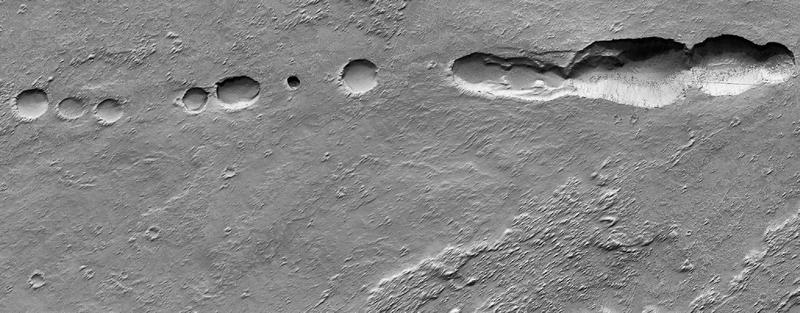 |
| Examples of Martian pit landforms possibly connected to caves. (Image: NASA, JPL-Caltech, UArizona, PDS Geosciences Node's Orbital Data Explorer for Mars Data Access) |
| Creating geological maps of planetary surfaces such as Mars is a complex process. From data collection to data analysis to publication in different formats – the production of maps is based on a time-consuming, multi-step process. |
| Deep Learning techniques, which use artificial neural networks to analyze data sets, can significantly improve the production process, as broadly shown in both scientific literature and applications. However, until now, open-source, ready-to-use, and highly customizable toolsets for planetary mapping were never released. |
| "We were interested in designing a simple, out-of-the-box tool that can be customized and used by many," said Giacomo Nodjoumi. The PhD candidate in the research group of Angelo Rossi, Professor of Earth and Planetary Science at Constructor University, was key to developing "DeepLandforms.” The program is open and available for further optimization, and showcases an inexpensive, fast, and simple approach to mapping planets in outer space. |
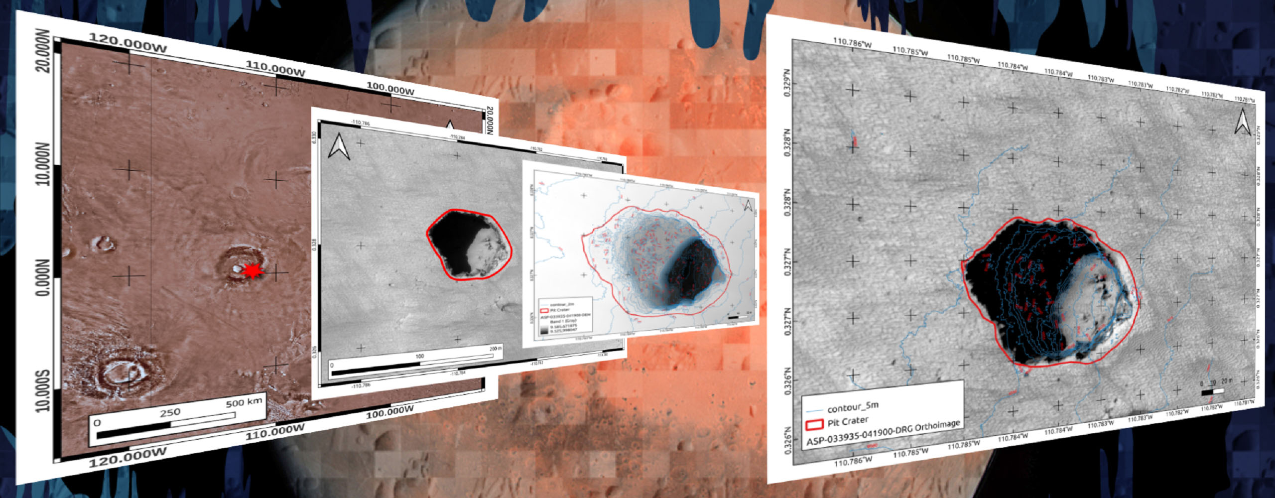 |
| Example steps from initial large-scale detection to semi-final geomorphological map of a pit near Pavonis Mons, Mars. (Image: NASA, JPL-Caltech, UArizona, PDS Geosciences Node's Orbital Data Explorer for Mars Data Access) |
| The scientists demonstrated the results that can be achieved with the help of the software for planetary mapping with a specific landform on Mars, which resembles lava tubes on Earth. Geological maps are an important tool in planetary exploration, because they also serve as a basis for possible explorations by robots or humans. |
| Source: Constructor University |